Australia Maps
World Atlas >

 The continent of Australia is sometimes called Oceania because it includes
several islands and atolls in the South Pacific. It covers a large area
and is home to New Zealand, Papua New Guinea, Australia, and all of Polynesia
and Melanesia.
The continent of Australia is sometimes called Oceania because it includes
several islands and atolls in the South Pacific. It covers a large area
and is home to New Zealand, Papua New Guinea, Australia, and all of Polynesia
and Melanesia.
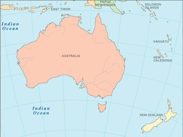
The Australian continent covers 3,132,059 square miles (8,112,000 square kilometers) and makes up less than 2% of the Earth's surface. The continent's size comes mainly from the country of Australia, which takes up 2,967,909 sq. mi. (7,686,850 sq. km.) of the total area.
The Australian continent is the smallest in the world, but it is surrounded by three oceans. The Southern Ocean is to the south, the Pacific Ocean lies to the east, and the Indian Ocean lies to the west. Australia is separated from Asia, its closest neighbor, by the Arafura and Timor seas.
 The highest point on the continent is Mt. Wilhelm in Papua New Guinea.
The mountain stands at 14,794 ft. (4,509 m.). In contrast, the lowest
point is Lake Eyre in Australia, which lies 52 ft. (16 m.) below sea level.
The highest point on the continent is Mt. Wilhelm in Papua New Guinea.
The mountain stands at 14,794 ft. (4,509 m.). In contrast, the lowest
point is Lake Eyre in Australia, which lies 52 ft. (16 m.) below sea level.
The land varies greatly within Australia. The interior of the country of Australia is very dry and arid. In fact, Australia is the driest continent that is inhabited. However, the northern portion of the country features a tropical climate and is home to a rainforest, grasslands, and mangrove swamps. The southern corners of the continent have a temperate climate.
The western side of Australia is covered by the Western Plateau, which is higher on the coast and lowers in elevation near the continent's center. Most of the area is fairly flat, but parts of it are covered by the MacDonnell, Musgrave, and Hamersley mountain ranges.
In the east of Australia lies the Eastern Highlands. Between the plateau and highlands sits the Central Lowlands, which encompass the Great Artesian Basin (a fresh water basin that is the deepest and largest in the world), the Murray-Darling Basin, and the Lake Eyre Basin. They make up Australia's largest river system.
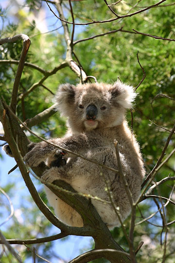
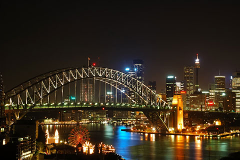
The continent of Australia is a popular travel destination. The islands in the South Pacific are a huge draw. They offer visitors a glimpse at a different kind of world and an opportunity to relax. Those looking for a more active vacation tend to flock to the Great Barrier Reef. It is the world's largest coral reef, located just off the northeast coast, and scuba divers love to explore here.
Australia Map
Interactive Australia Map
Australian Countries
For your convenience, this Australia atlas page also includes all of the nations which are considered part of Oceania. The table below lists these countries and their capital cities, and also features links to maps and detailed information about each country. Geographers and cartographers differ in how they categorize these Pacific Island nations. This atlas simply references them as "Australian," just as Caribbean Island nations are often considered part of North America.
| Australian Countries And Capitals | |
|---|---|
| Country Name | Capital City |
| Australia | Canberra |
| East Timor | Dili |
| Federated States of Micronesia | Palikir |
| Fiji | Suva |
| Kiribati | Bairiki |
| Marshall Islands | Majuro |
| Nauru | Yaren |
| New Zealand | Wellington |
| Palau | Koror |
| Papua New Guinea | Port Moresby |
| Samoa | Apia |
| Solomon Islands | Honiara |
| Tonga | Nukualofa |
| Tuvalu | Funafuti |
| Vanuatu | Port-Vila |
See the CIA World Factbook home page for information about this helpful geopolitical resource, and visit this map of Australia website for more Australia maps and Australian travel information.
World-Atlas.us is a Chosen Sites™ reference source.
To facilitate browsing, certain links will open in new windows.