Oceania Maps
World Atlas >


 Oceania is a term used to describe the Pacific island region, which
usually includes Micronesia, Melanesia, Australasia, and Polynesia.
The term is a loose one with ill-defined boundaries, but Oceania generally
includes Australia in the west and Pitcairn Island in the east, spanning
roughly 9000 miles across, and about 7000 miles from New Zealand to the
northern tip of the Philippines.
 Of course, such a wide region contains many different ecosystems and climates,
but most of the islands in the region enjoy a mild climate with moderate to heavy rainfall.
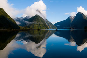
The continent of Australia and the islands of New Zealand
are much larger, and have different climates in different areas. Although Australia is the smallest
of all the continents, it is still a large and diverse landmass.
Australia's eastern coast varies from the hot and humid rainforests
of the north, to the temperate south. Most of the Australian
continent is a huge, arid desert that sees lots of sun. The
northeastern part of the country sees good amounts of rainfall, and is
prone to be in the path of cyclones. New Zealand enjoys a fairly
temperate climate in most areas, with temperatures rarely falling below
freezing. However, higher elevations, such as Mount Cook and the
Southern Alps on the South Island and volcanic Mount Taranaki on the
North Island, are subject to freezing temperatures.
The governments in the region range from the strong democracies found in Australia and New Zealand to various protectorates and foreign-held territories, such as French Polynesia, New Caledonia, American Samoa, and Guam. From time to time, as in Fiji, a military dictatorship even arises. Although the majority of the islands have been, or are still held by European powers during modern times, the native civilizations have inhabited some of the islands for thousands of years. The European influence has certainly impacted the region, for better and for worse.
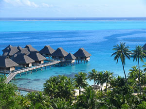
The region's economies range from the developed, first-world countries of Australia and New Zealand, to the developing ones of Indonesia and the Philippines, to the tiny local economies, dependent upon foreign funds, such as Guam. For many smaller islands, such as Fiji, Tonga, and Vanuatu, tourism is a major industry; the region remains one of the most visited, if difficult to reach, parts of the world.
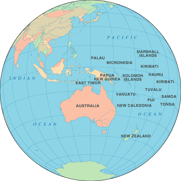
Oceania Map - Orthographic Projection

Interactive Western Oceania Map
Interactive Eastern Oceania Map
Oceanian Countries
For your convenience, this Oceania atlas page also includes all of the nations that are considered part of Australasia. The table below lists these countries and their capital cities, and also features links to maps and detailed information about each country.
| Oceanian Countries And Capitals | |
|---|---|
| Country Name | Capital City |
| Australia | Canberra |
| East Timor | Dili |
| Federated States of Micronesia | Palikir |
| Fiji | Suva |
| Kiribati | Bairiki |
| Marshall Islands | Majuro |
| Nauru | Yaren |
| New Zealand | Wellington |
| Palau | Koror |
| Papua New Guinea | Port Moresby |
| Samoa | Apia |
| Solomon Islands | Honiara |
| Tonga | Nukualofa |
| Tuvalu | Funafuti |
| Vanuatu | Port-Vila |
See the CIA World Factbook home page for information about this helpful geopolitical resource.
World-Atlas.us is a Chosen Sites™ reference source.
To facilitate browsing, certain links will open in new windows.

